Mapping Textures in Fill Mode
A GeoJSON geometry builds its own texture coordinates for the filled shape, so any material texture you assign has something to map onto. UV Options › Mode decides how those coordinates are worked out — either fitted to the shape, or anchored to the world.
Both modes produce the same kind of result — a texture across your filled geometry. The difference is what the texture is measured against, and that changes everything else about how it behaves.
Bounding Box:
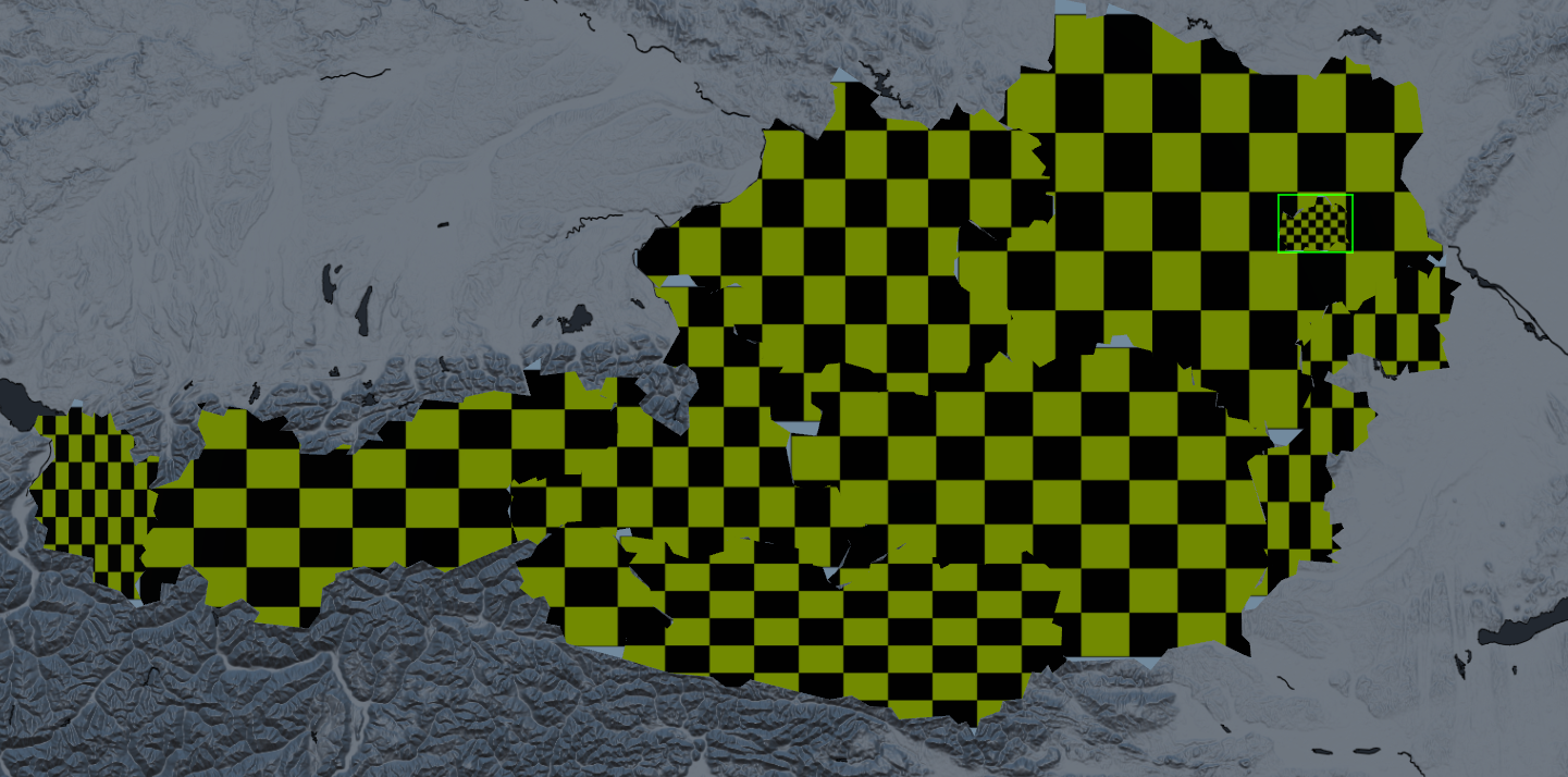
The texture is stretched to fill the shape’s extent exactly once, corner to corner. Whatever you assign shows up whole, whether the shape is a city block or a continent, and it looks the same however far you zoom the map in or out.
Reach for it when
You want one picture to fill one shape — a flag inside a country, a photo inside a region, a team colour ramp inside a district.
You are using a gradient and want it to run the full width or height of the shape.
The shape needs to look the same in a wide establishing shot and a tight close-up.
Worth knowing
Width and height are fitted independently, so the texture takes on the proportions of the shape. A circle in your image becomes an oval on a wide, flat shape.
One box covers everything in that geometry. Load a whole country’s districts into a single geometry and the texture spans the entire set once, not once per district.
Because the fit follows the data, the texture shifts and rescales whenever the extent changes — loading a different file, or adding a feature further out.
Two separate geometries get two unrelated fits, so a pattern will not carry across the border between them.
The Zoom value has no effect here.
World:
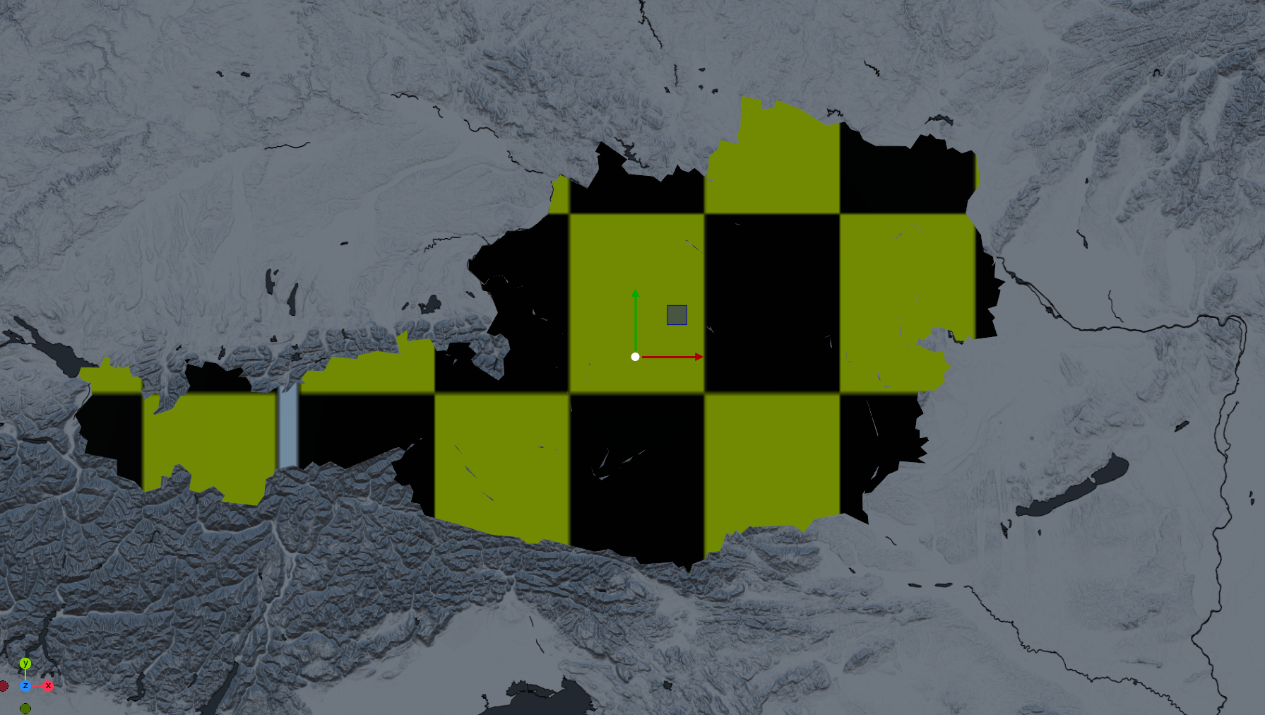
The texture is pinned to the map itself and repeats every so many meters on the ground. Each shape shows whatever part of that endless pattern it happens to cover, so the pattern has a real physical size and a fixed position — and it runs continuously from one shape into the next.
Reach for it when
You want a repeating fill — hatching, cross-hatch, dot screen, noise, water ripple, terrain — at a believable size rather than stretched to fit.
Several shapes must read as one surface: neighboring regions, a country split at the antimeridian, or an imported dataset where every feature becomes its own geometry.
You want the pattern to stay on the map, even when the data behind changes.
Small and large shapes appear together and should share the same visual texture weight.
Worth knowing
Set the material’s wrap to Repeat. The coordinates run well past 0–1, and on Clamp you will see one smeared edge pixel instead of a pattern.
It never auto-fits. A small shape at a low Zoom may only show one flat corner of the texture — raise Zoom until the pattern reads.
The grid is anchored at the map origin, so the pattern lands in the same place on the same ground every time you build the scene.
At high Zoom values the pattern repeats very densely and can shimmer. Mip-mapped textures handle this far better than sharp line art.
Zoom Levels (World Mode only)
Zoom works like a map zoom level: each step up halves the tile, so the pattern repeats twice as often. It ranges from 0 to 20, and only matters in World Tile mode.
Zoom | One tile spans | Reads as |
|---|---|---|
0 | 40 075 km | The whole world in one tile |
2 | 10 019 km | Continental |
4 | 2 505 km | Several countries |
5 | 1 252 km | A large country |
8 | 157 km | A region or state |
10 | 39 km | A metro area |
12 | 9.8 km | A city |
15 | 1.2 km | A neighbourhood |
18 | 153 m | A few city blocks |
20 | 38 m | A building footprint |
Distances are measured at the equator. Because the map is projected, the same tile covers less real ground the further you go towards the poles — roughly half as much at 60° latitude as at the equator.
Import defaults. When you import a .geojson or .fgb file as dynamic geometry, the import options carry the same two settings and stamp them onto every geometry the import creates. The importer makes one geometry per feature — which means on Bounding Box each feature is fitted separately, and on World Tile they all share one grid.
Mapping the outline
Switch Render Mode to Line and the geometry stops building a filled shape and strokes the borders instead. That stroke is its own mesh with its own texture coordinates, so it gets its own setting — Line Options › Tex Coord Mode. UV Options play no part here; changing UV Mode while rendering lines won’t make any visible changes for you.
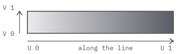
The two axes are fixed, and worth knowing before you make artwork for it: U runs along the line, from the start of the stroke to its end, and V runs across the thickness — 0 on one edge, 1 on the other. So a texture for an outline wants to be drawn as a strip: put the motif that should travel along the border across the width of your image, and whatever should vary from edge to edge up its height.
Contour Normalized
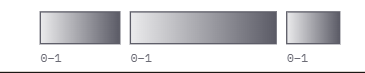
Every separate border runs U from 0 to 1 on its own. Each one shows the complete texture exactly once, however long or short it is — so a short border compresses the image and a long one stretches it.
Reach for it when
Each border should read as its own object: one arrow per border, one fade per border, a ribbon that starts and ends at the edge of each shape.
You are wiping borders on with Progress and want the leading edge of the texture to travel with the wipe.
Normalized
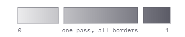
U runs 0 to 1 once across all the borders in that geometry, each picking up where the previous one left off. Every border shows only its share of the texture, in proportion to its length.
Reach for it when
You want a single color ramp or gradient to run across an entire dataset rather than restart on every border.
The borders should read as one continuous run of line, not as separate pieces.
Unnormalized

U is the distance travelled along the line, not a fraction of it. The texture repeats every fixed step of length, so the pattern is the same size on every border and long borders simply carry more repeats.
Reach for it when
You need dashes, ticks, chevrons or a rope pattern at even spacing, regardless of how long each border happens to be.
You are animating Progress and the pattern must hold its size instead of stretching as the visible length grows.
Unnormalized needs two things set up:
Set the material wrap to Repeat, and turn the texture scaling right down. U here is a raw map distance, so one repeat of the texture covers one unit of map distance - across a country-sized dataset that is thousands of repeats and reads as noise. Scale the material texture until the pattern is the size you want; for roughly one repeat per kilometre you are scaling by about a thousandth.
| Contour Normalized | Normalized | Unnormalized |
|---|---|---|---|
U is measured against | the length of each border | the total length of all borders | distance travelled |
Texture shows | once per border | once across the set | repeats by distance |
Pattern size, short vs long border | Different | Different | Same |
While Progress animates | Re-fits to the visible run | Re-fits to the visible run | Holds its size |
Wrap mode needed | Any | Any | Repeat |
Tex Coord Mode sits with Thickness, Progress and Progress Mode under Line Options, and is set per geometry.