Viz World Plug-ins Guide
Version 17.0 | Published January 10, 2019 ©
Center Map
![]()
The Center Map plug-in is used with map objects to keep a point on the map in the center of the map object. The map is moved while the defined point remains centered. With a Flat map, the map is moved, but with a Globe map the globe is rotated. See also Map Tiler for more information on Flat and Globe maps.
Note: The Center Map plug-in should only be applied to map objects.
Note: This plug-in is located in: Built Ins -> Container plug-ins -> Maps
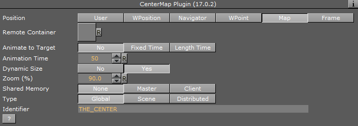
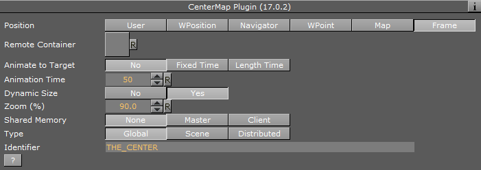
Center Map Properties
-
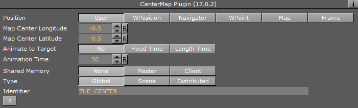
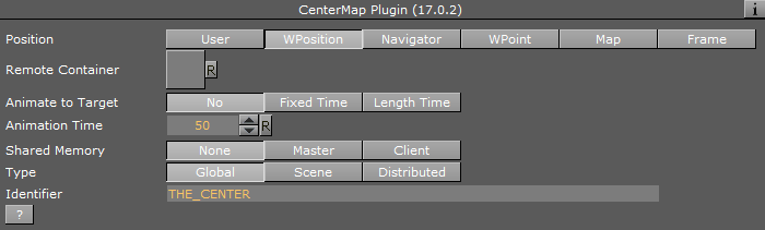
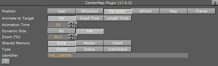
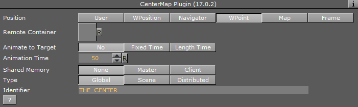
Position: Defines how the map is centered.
-
User: Enables the user to manually define a center point by setting Map Center Longitude and Map Center Latitude values.
-
WPosition: Centers the map at the location of a WPosition container dragged into the Remote Container place holder.
-
Navigator: Centers the map at the location of a Navigator container dragged into the Remote Container place holder.
-
WPoint: Centers the map at the location of a WPoint container dragged into the Remote Container place holder.
-
Map: Centers the map at the center of a dragged map into the Remote Container map.
-
Frame:
-
-
Remote Container: When Position is set to WPosition, you must drag the container that holds the World Position plug-in to this field in order to get the information.
-
Map Center Longitude/Latitude: Defines information for when Position is set to User.
-
Local Scale: Sets the scale parameter for the map.
-
Animate to Target: Animates the map whenever the longitude/latitude value changes when enabled. This is either with a fixed defined time or using length time, it is relative to the distance it has to travel to the new value.
-
Animation Time: Target value (in fields) for the animation.
-
Shared Memory: Writes the longitude/latitude values to the shared memory variable defined in the Identifier field when set to Master. When set to Client it listens for values in the shared memory key.
-
Type: Determines the type of shared memory to use (for more information on Shared Memory see the Viz Artist User Guide):
-
Global: Scene.Map: This is the map local to the current Scene. Every scene has one map that can be used to exchange data among the scripts in the Scene.
-
Scene: System.Map: The system-wide map allows for data sharing among the scenes currently loaded into memory.
-
Distributed: VizCommunication.Map: A distributed map that enables data sharing among the computers connected to one Viz Graphic Hub.
-
-
Identifier: Identifier to be used for shared memory communication.