Viz World Plug-ins Guide
Version 17.0 | Published January 10, 2019 ©
World Position
![]()
The World Position plug-in places an object over a geographically referenced map by setting the Longitude, Latitude and Altitude parameters. When the object is moved over the map, the current values of Longitude, Latitude and Altitude are updated in the World Position plug-in. The object with the World Position plug-in must be placed under a map in the hierarchy.
Note: This plug-in is located in: Built Ins -> Container plug-ins -> Maps
World Position Properties
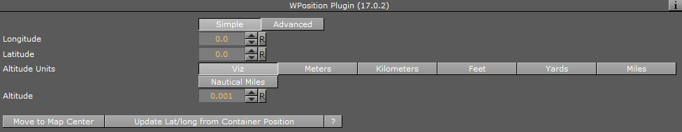
Simple
-
Longitude: Sets the parameter to the requested longitude. The object moves over the map to the requested location. Another option is to move the object and read its longitude value from this field.
-
Latitude: Sets the parameter to the requested latitude. The object moves over the map to the requested location. Another option is to move the object and read its latitude value from this field.
-
Altitude Units: Selects the units that the altitude parameter uses.
-
Altitude: Sets the parameter to the requested altitude. The object moves over the map to the requested location. Another option is to move the object and read its altitude value from this field.
-
Move to Map Center: Moves the object to the center of the parent map when clicked.
-
Update Lat/Long From Container Position: Updates the latitude and longitude position parameters when clicked.
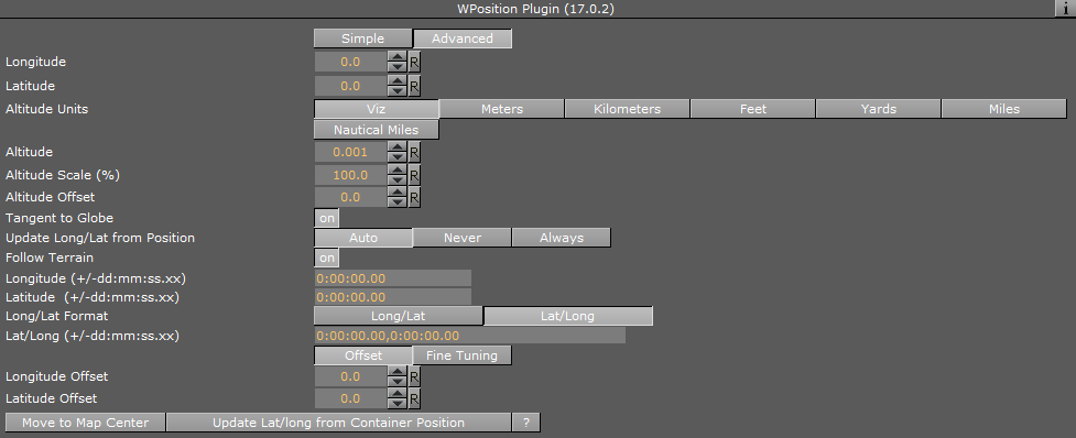
Advanced
In addition to the fields in the Simple tab, the Advanced tab has the following fields:
-
Tangent to Globe: Keeps the object parallel to the globe surface when set to On. The parameter is enabled when the World Position plug-in is placed in a child container of a container with a Globe plug-in.
-
Update Long/Lat from Position: Gets the current container location and updates the longitude, latitude and altitude parameters:
-
Auto: Updates the longitude and latitude values once when a new position is dragged over the container and never again.
-
Never: Updates the longitude and latitude values, but never updates the object's position.
-
Always: Updates the World Position when it changes and always checks the object's position.
-
-
Follow Terrain: Reads the height (Altitude) from the terrain in case of a terrain geometry.
-
Longitude/Latitude: Determines the position in degrees:minutes:seconds format.
-
Long/Lat Format (Long/Lat)(Lat/Long): Sets the format of incoming data.
-
Lat/Long (+/-dd:mm:ss.xx): Sets both latitude and longitude values in a single string.
-
Offset/Fine Tuning
-
Longitude/Latitude Offset: Positions the object at a given offset from the actual longitude/latitude when Offset is selected.
-
Longitude/Latitude Seconds: Provides fine tuning values in seconds when Fine Tuning is selected.
-