Viz World Plug-ins Guide
Version 17.0 | Published January 10, 2019 ©
Geo Text
![]()
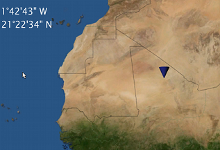
The Geo Text plug-in displays the longitude and latitude values received from a variety of sources. The geographic data is displayed in two text objects (or one) defined by the longitude and latitude containers.
Note: This plug-in is located in: Built Ins -> Container plug-ins -> Maps
Geo Text Properties
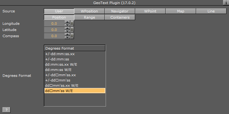
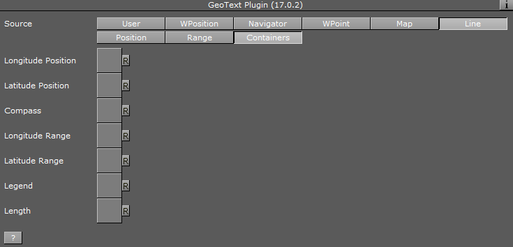
The Source defines the source of the geographic data that is displayed in the defined containers under the Containers tab.
-
Source: Defines the source of the geographic data that is displayed in the defined containers under the Containers tab.
-
User: Sets the value manually in the Compass, Longitude and Latitude parameters for the position and range values. The Compass, Longitude and Latitude parameters are enabled only when Position is set to User.
-
WPosition: Displays the values received from the World Position plug-in on the same container as the Geo Text plug-in in the defined Containers.
-
Navigator: Receives the geographic data from the Navigator plug-in in the scene. The received data from the Navigator plug-in is the location of the center of the Navigator point of view and the difference between the edges of the current Navigator map. The Geo Text plug-in also has placeholders (all requiring a running Viz World server) for defining the administration levels:
-
Country: Gets the current Country
-
Admin 1: Gets the current administration level 1 (e.g. Region)
-
Admin 2: Gets the current administration level 2 (e.g. Town)
-
Location: Gets the lowest administration level (e.g. Place)
-
-
WPoint: Displays the value received from the WPosition vmaps plug-in on the same container as the Geo Text plug-in in the defined Containers.
-
Map: Sends the center of the map data to the Longitude and Latitude containers and the difference between the edges of the map to the range containers when placed on a map container.
-
Line: Sends the center of the line data to the defined containers in the Containers tab when placed on a 3D Line container.
-
Position: Defines the position text format. Select the required format from the Degrees Format list.
-
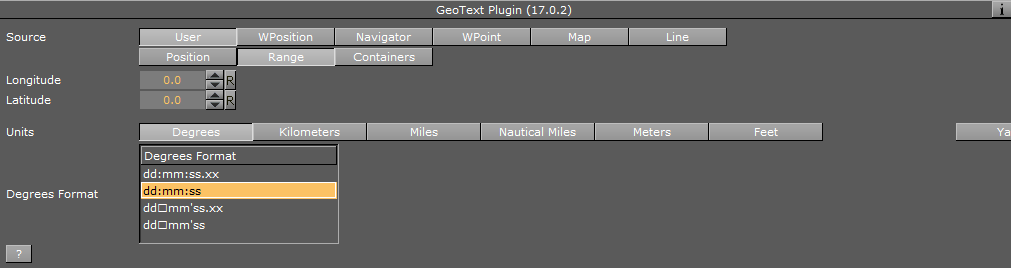
Range: Defines the range text format. Select the units for the displayed values and select the required format from the Degrees Format list. If Kilometers, Miles or Nautical Miles are selected, Dot or Comma can be selected as a separator with a fixed decimal point.
-
Containers: Defines the font objects that display the longitude and latitude values of the position and range:
-
Longitude Position: Links to the text object displaying the longitude position data received from the Geo Text plug-in.
-
Latitude Position: Links to the text object displaying the latitude position data received from the Geo Text plug-in.
-
Compass: Links to an object that is rotated to show the North (based on navigator direction).
-
Longitude Range: Links to the text object displaying the longitude range data received from the Geo Text plug-in.
-
Latitude Position: Links to the text object displaying the latitude range data received from the Geo Text plug-in.
-
Legend: Scales view width and view height values based on the object used for the legend.
-
Length: Links to the text object displaying the length of the line object as received from the Geo Text plug-in.
-
-