
Viz World Classic User Guide
Version 23.0 | Published December 12, 2023 ©
How Stylesheets Work
A stylesheet defines all the properties and design conventions used to draw a map. Each map layer has a stylesheet associated with it which determines its appearance.
The stylesheet defines:
-
The predefined styles, and any additional user-defined styles.
-
The markers used to identify map details.
-
The textures available for use as textures for regions.
-
One or more default lights for the map layer.
-
Additional properties of the map including land shadow, relief, and line widths.
Once created, a finished project can be changed to a different set of design conventions simply by loading in a different stylesheet.
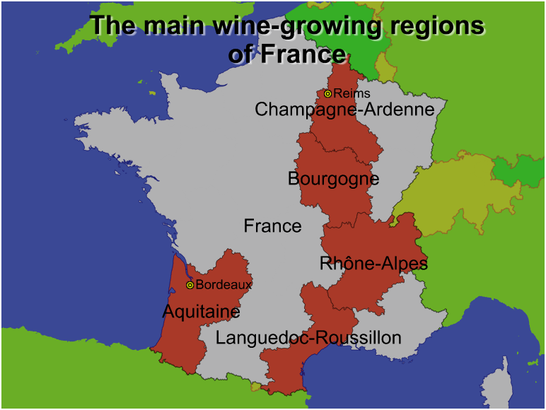
For example, the above project was created using the default stylesheet.
The project can then be instantly converted to a totally different house style simply by loading in a different stylesheet.
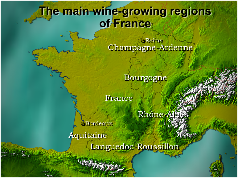
For example, one stylesheet could include texturing and lighting effects.
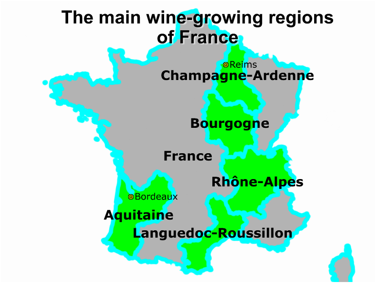
For another project loading a stylesheet could create a much simpler appearance with flat lighting and thick line widths.
Multiple Stylesheets
If your project includes more than one map layer you can apply a different stylesheet to each map layer. For example you might have one house style for the main map in a project and another house style for an inset map.